Saturday, June 26, 2021

Streets named Catani

I have been for a few drives and photographed all the Catani street signs in Victoria. There is also a Catani Place in Monash in the A.C.T., of which I received some photos from a kind Canberrian. There is also a Catani Place at Helensvale in Queensland, north of the Gold Coast, the only sign not photographed.  For a short time (1918-1919) The Boulevard which runs between Heidelberg and Ivanhoe, was called Via Catani, and I have written about this here.


Catani Boulevard, Bend of Islands. The sealed road is Henley Drive.

Catani Boulevard, Bend of Islands

Catani Boulevard, Bend of Islands, is the most scenic of the Catani streets. Bend of Islands is an Environmental Living Zone, part of the Shire of Nillumbik and the location of the Warrandyte-Kinglake Nature Conservation Reserve. The name  comes from the fact that the Yarra River bends around and there is a small island in the bend, called Moniques Island. You can see the Bend of Islands Conservation Association website, here

Catani Boulevard was established in 1929. Mick Woiwod, in his book Once Around the Sugarloaf (1) describes how it came about in March 1929, Ned Haughton subdivided his 320 acre estate into thirty-six lots - thirty-five of which had river frontages, averaging five acres apiece, with the remaining land-locked central block measuring 124 acres. Access to the river blocks was provided for by the construction of a circuitous road (Via Catani Boulevard), carved out with horse and scoop by Jack Kennedy, a local contractor.......Aware of Catani's universal popularity, Ned Haughton named the road through his subdivision 'Via Catani Boulevard' (2).

Aubrey Edward 'Ned'  Haughton was an auctioneer and real estate agent from the firm of Coghill & Haughton (3).  He admired Carlo Catani's vision of a grand boulevard which would run from Princes Bridge to Yarra Glen and in 1927 decided to take on the project. The Herald reported on his plans - Few citizens, perhaps, remember that the late Mr Catani, the noted Public Works officer, visualised a river boulevard from the city to Yarra Glen, where it would join the Healesville road, and at Healesville link up with the highway over the Blacks' Spur and the mountains beyond - to Sydney....Applying himself to the task of "seeing it through"  Mr A. E. Haughton (of Coghill and Haughton, city) appeals to citizens and Government departments concerned to help forward the great driveway scheme. 

Mr Haughton  divides the driveway into three sections, as follows: 1. Prince's Bridge to Heidelberg. This is being looked after by the Public Works Department. The Lake Thwaites' scheme has  been planned on this section.  2. Heidelberg to Warrandyte, via Eltham. This section can easily be arranged, as recent sub-divisons and existing Government roads need only a few additions to make it possible. 3. Warrandyte to Yarra Glen on the north side of  the river. This is the longest section, and the land is held by only a few owners. Mr Haughton considers that "the  Government should acquire the big timber areas before they are converted into week-end sites, which is likely to happen soon." (4). 

Sadly, neither Carlo's nor Mr Haughton's vision ever came to fruition. You perhaps might wonder if Mr Haughton's vision of the grand boulevard was influenced by the prospect of increasing his business through land sales along the route. Table Talk profiled him in 1914 and had this to say -  Land salesmanship is Mr. Haughton's forte, he combines with a sound, all-round knowledge of town and country values a persuasive address, which counts for a great deal at an auction sale (5). 


In 1975 you could have purchased 8 acres on Catani Boulevard for $21,000. 
The Bend of Islands area was previously part of Kangaroo Ground. 
The Age, November 15, 1975


Catani Court, Broadmeadows.

Catani Court, Broadmeadows, is in my 1973 Melway, but not in the original 1966 Melway, so this gives some idea when the Court was established. It is in the City of Hume. It was very hard to take an attractive photo of the sign; as you can see from the photo the housing estate was established before the days when power lines were placed underground. Catani Court is in a pocket of streets named after Victorian towns - Heywood, Dimboola, Cavendish, Coleraine, Timboon, Sorreno, Benambra amongst others. 

Catani Court, Burnside Heights

Burnside Heights is part of the City of Melton. Catani Court was proclaimed in 2006 according to the City of Melton Road Management Plan, see below. Catani Court is off Arbour Boulevard and some of the  surrounding street are named after parks - Como, Domain, Hyde, Regent, Centennial, so I presume that is the reason Catani was selected.


City of Melton Road Management Plan, March 2021

Catani Mews, Caroline Springs

Nine hundred metres from Catani Court, Burnside Heights is Catani Mews, Caroline Springs. Catani Mews was proclaimed in 2004 according to the City of Melton Road Management Plan, above. Catani Mews is also in a pocket of streets with Park names - Studley Park Way, Kings Domain, Edinburgh Lane and a street called Alexandra Gardens.


Catani Place, Craigieburn

Catani Place in Craigieburn, is also in the City of Hume. It seemed to be a very short street - 20 metres, if that, which lead to a gate, but I have just found that 4-10 Catani Place was sold in November 2016 in one lot as 6 residential properties being 'offered in one line' allowing purchasers to secure residential investments with commercial returns. Tenant: Department of Education & Training.  Lease Term: 15 years (comm. Feb 2003) plus options. These houses were all behind the gate, so it is a small gated community. This is the advertisement for the sale, here. Catani Place was in the 2003 Melway in dotted lines, which is what they use to denote proposed developments.  Studley Park Way, Fawkner Lane, Kings Glen are three close streets, so I presume it was named to fit into this Garden theme.


Catani Lane, Curlewis. The Land borders Connor Park. 

Curlewis is around 20 km past Geelong. Catani Lane is in the Curlewis Parks Estate, which was established around 2011. The Estate was originally advertised as being in Drysdale, but is now called Curlewis. Curlewis itself is an old locality. Coriyule Homestead, built in 1849 for pioneer squatters Anne Drysdale and Caroline Newcomb, is located in Curlewis. Curlewis Catholic School was established  in January 1851, changed it's name to Point Henry in 1869 and closed in December 1873. Curlewis State School, No. 1559, operated form 1875 until 1880 (6).  Catani Lane is surrounded by Chatsworth Way, Hyde Way, Centennial Boulevard and streets with English names - I can't see a connection between Catani and the other street names. Connor Park was presumably named for the pioneering Connor family (7).


Catani Avenue, Koo Wee Rup

Catani Avenue, Koo Wee Rup is in the Shire of Cardinia, as is the town of Catani. It is in the Shelton Park Estate, established around 2010. In my 2015 Melway, Catani Avenue came off Rossiter Road, and it was still like that in December 2018 when Greg, Nima and Katherine Catani visited as we took a photo of them under the sign, but part of it has now been changed to Shelton Park Drive. The street was named for Carlo Catani, who was of course responsible for drainage works on the Koo Wee Rup Swamp from 1893.


This is from the 2015 Melway Greater Melbourne Street Directory, clearly showing Catani Avenue (bottom left) running off Rossiter Road. Today that section of Catani Avenue is called Shelton Park Drive and Catani Avenue starts where it turns eastwards.


Catani Court, Newborough. 
Looking south down Dinwoodie Drive, with the Strzelecki Ranges in the background. 

Catani Court is in what appears to be a 1980s sub-division. Surrounding streets include Dinwoodie Drive - there was a Dr Collin Dinwoodie who practiced in Moe in the 1920s (Moe is the town adjacent to Newborough); Howitt Street - Alfred Howitt was an explorer; Strzelecki Road - Count Strzelecki - another Gippsland Explorer; McMillan Court - Angus McMillan - yet another Gippsland explorer; McDonald Court -  presumably George McDonald who surveyed McDonald's Track from Lang Lang into the Strzelecki Ranges.  So, am I assuming that the name Catani was selected due to his work of  draining the Moe Swamp. 


Catani Place, Monash, A.C.T. 
Image courtesy of Gaia Livni  (© Gaia Livni)


Catani Place, Monash, A.C.T. Looking down William Hudson Crescent to 
Thompson Place playground. 
Image courtesy of Gaia Livni (© Gaia Livni)

Catani Place is in Monash, a suburb of Canberra. Monash is named after Sir John Monash (1865-1931) Engineer, General and Chairman of the State Electricity Commission of Victoria. Along with Carlo, other engineers are also honoured in this sub-division by having streets named after them. Here are a few - William Hudson Crescent - William Hudson (1896-1978) - Commissioner of the Snowy Mountains Hydro-Electric Scheme; Scratchley Place - Sir Peter Scratchley (1835-1885), Military Engineer; Ballard Place - I presume this is Robert Ballard (1839-1912), Railway Engineer; Arnot Place - Arthur James Arnot (1865-1946), Electrical Engineer; Checchi Place - Ettore Checchi (1853-1946) - Engineer, specialising in hydrography and friend of Carlo. They migrated to Australia together along with Pietro Baracchi. Steffanoni Circuit - Victor Lewis Steffanoni (1901-1974) - Surveyor and Military Engineer. You can find more information about these chaps in the Australian Dictionary of Biography https://adb.anu.edu.au/ The only one not listed is Mr Steffanoni, I found out about him from the Australian Capital Territory Public Place Names Act 1989 Determination No. 73 of 1990 (see here).This also gives as idea of when this sub-division was created - around 1990.


Acknowledgement
Isaac Hermann, my Carlo research colleague, compiled the original list of Catani Streets. He also supplied the photo of Catani Lane, Curlewis. I added the other photos and the details, mainly using my extensive collection of Melway Street Directories, however it was Isaac who told me about Mick Woiwod's book and thus Ned Houghton's original land sub-division on the Bend of Islands. Thanks, Isaac. Isaac also organised for the photo of Catani Place, Monash, Canberra to be taken. Thank you to Gaia Livni for taking the time and effort to photograph Carlo's Canberra street sign for me.  I was so thrilled to receive the photos.

Footnotes
(1) Woiwod, Mick Once around the Sugarloaf: the transformation of a Victorian landscape and the story of its people (Bend of Islands Press, 1992).
(2) Woiwod, op. cit, p. 197 and 201.
(3) Audrey Edward Haughton was the son of William Haughton, Town Clerk of Oakleigh, He married Jessie Cameron on May 16, 1906. She was the daughter of Ewan Hugh Cameron, M.L.A. Their wedding notice was in The Argus June 15, 1906, see here. He was profiled in  Table Talk, January 29, 1914, see here.
(4) The Herald, April 13, 1927, see here.
(5) Table Talk, January 29, 1914, see here.
(6) Curlewis School information from Vision and Realisation : a centenary history of State Education in Victoria, edited by L.J. Blake. Published by the Education Department of Victoria, 1973.

Wednesday, May 26, 2021

Carlo and the Lubecker Steam Bucket dredge

Photographs of Carlo are very rare but my research colleague and fellow Carlo Catani historian, Isaac Hermann, has just identified him in these two photographs of the Lubecker Steam Dredge.  Carlo Catani spent four months in Europe in 1912 and while he was away investigated various dredges and selected the Lubecker steam driven bucket dredge. I have written about the dredge here.

The photographs were taken, I believe, on May 21, 1914. According to the Lang Lang Guardian it was on this day that the dredge on the Lang Lang River was started in the presence of a representative official party, including Mr Hagelthorn (Minister of Public Works), Messrs Cattanach and Dethridge (members of the Water Supply Commission), with Mr Catani (Chief Engineer of the Public Works Department), Mr Kenyon (Chief Engineer of the Water Commission), Mr Drake (secretary Public Works Department), Mr Kermode (engineer Ports and Harbors), and Mr Grenlees (naval architect). There was also a representative attendance of landowners of the surrounding district and others interested in the starting of this machine, and the weather being pleasantly fine and sunny, those who attended had an enjoyable outing, as well as being greatly interested witnesses of the working of a machine which is the first of its kind to be put into operation in Australia.

The Lang Lang Guardian also reported that there had been a trial run on April 15, at which Carlo was present. You can read the full report in the Lang Lang Guardian of May 27, 1914, here.


The Lubecker Steam Bucket Dredge May 21, 1914. Carlo is second from right.
Channels and channel excavation in the Lang Lang (Koo-wee-rup) district. State Rivers and Water Supply Commission photographer. State Library of Victoria Image rwg/u866


This is a cropped section of the photo above. This is clearly Carlo on the right, with a set of plans in his hand. Compare the hat and the coat to this photograph of him, below,  at the load bearing test of the Anderson Street bridge, in 1899. Isaac and I have written about the Anderson Street bridge in our Victorian Collections story on Carlo Catani, here.


Carlo is in the front row, second from left - same style of hat and coat, as in the image above. Under his overcoat is his characteristic sac suit, read more of this here.
Test of Anderson St. Bridge, 1899. Photographer: S. Brearley. Image:  National Library of Australia


The Lubecker Steam Bucket Dredge May 21, 1914. Carlo is on the ladder.
Channels and channel excavation in the Lang Lang (Koo-wee-rup) district. State Rivers and Water Supply Commission photographer. State Library of Victoria Image rwg/u855


This is a cropped section of the photo above - that's Carlo on the ladder.

There are other photographs of the Lubecker Dredge taken on the same day at the State Library of Victoria, access them here.

Saturday, May 15, 2021

Carlo and the Chalet Geneve on Albert Park Lake

The Albert Park Lake Kiosk was officially opened on December 9, 1911 by the Mayor of South Melbourne, Cr Donald McArthur. His speech was reported in The Age - The kiosk was an ornamental and imposing structure, and it would add to the improvement and beautification of the park, which, with its area of 600 acres, gave breathing space to the the residents of the city and suburbs.... The park was a national park, open to everyone in and around Melbourne (1).

Also present were other South Melbourne Councillors, Councillors from St Kilda and other officials such as Henry Allen, Secretary of the Albert Park Committee and Carlo Catani. The Kiosk, later renamed the Chalet Geneve, was operated by Rosana Savary and her sisters, Frances and Katherine Mathieu. I have written in detail about the Chalet and the Mathieu sisters and their operation of the Chalet Geneve as well as the ones in the Fitzroy Gardens and Central Park, Malvern in another blog post, here (2). 

This post is about the role Carlo played in establishing the Albert Park Lake Kiosk and his reported speech on the day. We (3) have also found a photo of Carlo and a very rare photo of his wife, Catherine, at the opening ceremony, which you will see below.

The refreshment kiosk at Albert Park Lake was one part of grander plans for the Park proposed by the Albert Park Committee or Trust. In 1907, there were newspaper reports that £10,000 would be spent beautifying the park and that a scheme be prepared by Mr. Catani, engineer of the Public Works department, and the engineers of the two councils for consideration (4). Nothing came of this, but two years later the South Melbourne Council proposed a £20,000 scheme for improving Albert Park. It was suggested that once again Mr Catani should prepare a comprehensive scheme for the improvement of the park (5).  However, in the end the Council decided that they should call for competitive designs for the park and the winning designer would receive £50 (6). As the money for this scheme was not forthcoming it did not go ahead, however the Albert Park Committee, of which Carlo Catani was a member, proceeded with the idea of building a kiosk (7).


The Chalet Geneve, photographed on the opening day, December 9, 1911.

Carlo was invited to speak at the opening and his speech was reported in the Prahran Telegraph thus - Mr C.Catani, C. E., said that to improve the park £25,000 would be required - as a beginning. They would have to begin by making a promontory to take off the flat look and to show the landscape. They required to raise the ground, and they wanted to get rid of the
Tips to the right of us,
Tips to the left of us,
Cows all around us.
They wanted the Government to give them a big waggon to bring plenty of good soil, so as to raise the level of the ground by two feet, and they wanted to plant trees properly. That would take money. It was up to the Trust to raise £25,000, and he would undertake that it was spent properly
(8).


Tips to the right of us....
Prahran Telegraph, December 16, 1911, see https://trove.nla.gov.au/newspaper/article/165112312

The report of the opening in the Prahran Telegraph had the heading - Albert Park Tea Kiosk. Official Opening. 'The Cow Ranch' (9)The Albert Park Committee allowed the agistment of cattle and other livestock in Albert Park, because it was a source of income. In 1907 it was reported that there were 129 horses, 210 cows and 43 calves in the Park (10).  At the opening of the Kiosk in December 1911, Cr Baragwanath of South Melbourne said the Trust had been doing a good bit of work up to date, but he would not be satisfied until the cows and horses were out of what he called the Cow Ranch (11).  Cr O'Donnell of St Kilda, responded to this the Trust had done its level best to improve the park, but he didn't know about getting rid of the cows which Cr Baragawanath talked of. The cows gave them an income of £600 a year, which enabled the Trust to improve the park (12).

One of the  tips which Carlo referrred, was still there in 1930. The burning off in the tip was apparently a source of distress to the thousands of people who attended the football at the Park, even though Miss Fitzpatrick, who was then the owner of the Chalet had no complaints (13).


Guests at the opening ceremony of the Chalet Geneve, December 9, 1911.

This post is a brief look at the role Carlo played in the development and opening of the Albert Park Chalet. The guests at the ceremony are pictured above.  Seated at the first table on the left is the Mayor of South Melbourne, Cr Donald McArthur. Next to him is Henry Allen, then the dignified woman with the fur stole is Catherine Catani and next to her is Carlo. I have never seen a photo of Catherine before, so even though it is very grainy, it is gold.


The very rare photograph of Catherine Catani and Carlo.
Opening ceremony of the Chalet Geneve, December 9, 1911. Punch, December 14, 1911   https://trove.nla.gov.au/newspaper/article/177535383#


Acknowledgement
It was my colleague, Isaac Hermann, who on closer examination of the photo of the guests at the opening of the Chalet Geneve, discovered that Carlo and Catherine were front and centre in the photo.  It was an amazing discovery. As I said, we have never seen a photo of Catherine before. Great work, Isaac. 

Trove - I created a list connected to the Albert Park Chalet and the two other refreshment kiosks operated by the Mathieu sisters - one in the Fitzroy Gardens and the other at Central Park, Malvern. Access it here.

Footnotes
(1) The Age, December 11, 1911, see here.
(2) https://victoriaspast.blogspot.com/2021/04/the-chalet-geneve-on-albert-park-lake.html
(3) I say we, but it was actually, Isaac. See the Acknowledgment.
(4) Emerald Hill Record, June 8, 1907, see here.
(5) Prahran Telegraph, August 28, 1909, see here.
(6) Prahran Telegraph, August 28, 1909, see here.
(7) Barnard, Jill & Keating, Jenny People's Playground: a history of the Albert Park (Chandos Publishing, 1996) p. 74.
(8) Prahran Telegraph, December 16, 1911, see here.
(9) Prahran Telegraph, December 16, 1911, see here.
(10) Barnard & Keating, op. cit, p. 70.
(11)  Prahran Telegraph, December 16, 1911, see here.
(12)  Prahran Telegraph, December 16, 1911, see here.
(13) Emerald Hill Record, June 7, 1930, see here.

Saturday, May 8, 2021

Above the clouds - Trout fishing in Lake Catani

Carlo was responsible for opening some of Victoria's most scenic tourist areas, of which Mount Buffalo is the best-known. The road between Porepunkah and Mount Buffalo was engineered by Carlo and officially opened by the Victorian Premier, Thomas Bent, in October 1908. The Mount Buffalo Chalet, was opened around August 1910 and provided accommodation for the tourists (1).  

One of the attractions of the area was a lake, formed by the construction of  a weir across Eurobin Creek. The lake was 23 hectares (56 acres) in size. In January 1911, The Age reported that Acting on the suggestion of the Bright Shire Council, the Government has decided that the picturesque lake on the top of Mount Buffalo shall be named Lake Catani. This is considered to be a well-deserved recognition of the work done by Mr. Catani, chief engineer of the Public Works Department, in connection with the opening up of Mount Buffalo as a tourist resort. The construction of the lake was suggested and carried out by Mr Catani (2).


Lake Catani, Mt. Buffalo. Photographer: Alice Manfield.
State Library of Victoria Image H2003.97/5

Lake Catani was stocked with trout, and in January 1913 a 4lb trout was caught just below the weir, the largest trout that has yet been obtained, as Carlo was informed (3).  It's interesting that not only was Carlo informed of the catch, but it was reported in the newspapers (see below). There would be very few senior public servants today who are as well known or as respected.


A 4lb trout is caught in Lake Catani

There was another report of a record trout being caught in Lake Catani, a month later. This trout was caught when Carlo accompanied the Premier of Queensland, Mr Digby Denham (4) and his wife, Alice to Mount Buffalo.  The Denham's were on a trip to the southern States - From Adelaide, a visit was paid to the Buffalo, which was reached by motor. Mr. and Mrs. Denham were accompanied by Signor Catani, who is known as the "father of the Buffalo," and after whom the lake is called. In Lake Catani, the party caught a trout, weighing about 5lbs., which is remarkable, in that it was the first trout in
those parts to be taken by a hook. 


Carlo accompanies the Queensland Premier and Mrs Denham to Mount Buffalo
 and a record trout is caught.

A year later, in February 1914, The Argus (5) published a enthusiastic account of trout fishing in Lake Catani. I am sure if Carlo had read this, he would have been very happy to know that his work in creating a tourist resort was appreciated. The article is transcribed here and provides an interesting look at the resort on Mount Buffalo only a few years after its establishment

ABOVE THE CLOUDS - TROUT FISHING IN LAKE CATANI By J.O.S.

A few years ago a little splashing gurgling creek meandered across a plain on the top of Mount Buffalo and then threaded its course between the walls of a deep and rugged gorge and eventually found its way to the foot of the mount. What became of it afterwards is of small moment, but it doubtless made its way per the medium of deeper and wider streams to the sea. With the establishment of the comfortable  and commodious Government chalet on the Buffalo Plateau the idea occurred to somebody that it would be possible by the simple expedient of throwing a wall across a narrow part of the gorge to transform the somewhat unlovely marsh plain into a beautiful mountain lake and as a result Lake Catani is there to-day to gladden the eye of the tourist with its broad expanse of glittering sapphire water and to enhance the interest as well as the beauty of that wonderful region which has well earned its poetic title "The Garden of the Gods."

It seems incredible when one stands on the sloping shore of this beautiful sheet of water watching its rippling wavelets, rejoicing in the glory of its sixty broad acres that the hand of man had had anything to do with its creation. There are capes and promontories, bays and inlets, grass grown hanks spangled with wild flowers and where the sides of the gorge rise precipitously from the water, great snow gums thrive and throw their shadows over the deep and silent pools. When one stands on the top of the Monolith rock that huge and wonderful boulder 40ft in height balanced on the edge of a mighty granite outcrop-and gazes down into the shimmering blue depths immediately below, he is reminded of pictures he has seen of some beautiful Swiss like scene, and he wonders if the colouring is not too blue to be natural.


Lake Catani from the Monolith. Photographer: Alice Manfield.
State Library of Victoria Image H2003.95/99

Perhaps Lake Catani with all its fresh novelty and with all its beauties would possess but scanty charms for the tourist who is also something of an angler were it not plentifully stocked with English trout.  That beneficient Government that has done everything connected with the tourist's comfort and convenience on this wonderful mountain so well has attended to the business of stocking this lake in a manner quite on a par with its splendid work in other departments. To stand near the water on a balmy summer evening and see the surface agitated as far as one can see with leaping fish, one realises that the lake is literally teeming with trout. That they thrive well in this region there is no question. It is said that during the past four years the Government has liberated fifteen hundred yearling trout each season. It is on record properly authenticated that fish have already been taken over five pounds in weight. During the past three weeks I have caught dozens of trout in the lake, several weighing between two and three pounds, and scarely any under a pound and a half. These fish are lusty and full of fight and afford the best of sport. They rise readily to a grasshopper whipped on the surface (particularly in the evening) and they will take any ordinary ground bait such as worm, white grub or frog at any hour of the day. The best plan for frog bait fishing during the bright sunny hours is to cast well out from the bank for your trout is a shy, suspicious creature and if he sees you he forgets that he is hungry. As the shadows deepen and the water loses its transparency it is quite common to hook a good fish quite close to the waters edge.


Sunset, Lake Catani. Photographer: Alice Manfield.
State Library of Victoria Image H2003.97/50

It is only a pleasant quarter of an hour's walk from the Chalet to the lake and all the good fishing spots can be easily reached for there are a couple of excellent boats placed there for the convenience of visitors and a short pull will take you to any given point. From my impressions of a most enjoyable holiday just spent on the Buffalo, I am of opinion that this spot will soon attract great numbers of trout fishers who will be able to indulge in their favourite sport under the most favourable conditions. For in addition to the fishing ground being so close to the base thus obviating the usual necessity of exhausting tramps through miles of scrubby undergrowth, the Chalet itself offers all the comforts of a luxurious home and even a tired trout angler can appreciate the joys of a hot plunge and a cold shower after a busy day. Splendidly managed and capably staffed the comfortably built residence on the edge of the gorge is always a good place to come home to, and I know of nothing better than to drop into an easy posture on "Bent's Look-out" as the shades of evening deepen into purple, light a fragrant pipe, gaze over the miles of rolling hills and valleys that stretch below, and reflect that another heavy basket has gone round to the kitchen to be dealt with in due course by that very important member of the entourage - the chef.


I wonder if this is one of the excellent boats placed for the convenience of visitors, as referred to above. This photo also shows the weir, the construction of which, on the Eurobin Creek, formed Lake Catani.
Lake Catani, Mount Buffalo, c. 1911. Photographer: Herbert Percival Bennett.
State Library of Victoria Image H88.24/2. This photo was on a stereocard and has been cropped.

Three of the photographs on this page were taken by Alice Manfield (1878 - 1960).  Alice was born in 1878 to James Samuel Manfield and Jane Douglas Simpson, she was the eighth of their ten children (6). Alice married a cousin, John Edmund Manfield on December 1, 1917 at the Cecil Street Methodist Church in South Melbourne. They had a daughter, Genevieve, on June 3, 1919. Alice died July 14, 1960 (7).  Alice's father had acted as a guide to tourists on Mount Buffalo and in the late 1890s the Manfields built a Chalet or Hospice to accommodate guests (8). Alice acted as a guide, in fact, she was known as 'Guide Alice'.  So well known was she by this name that she used it in birth announcement of her daughter, Genevieve.


Birth announcement of Genevieve - love the use of 'Guide Alice' as her 'nee' name!

Alice was also a noted photographer and naturalist.  In 1924, she wrote a book The Lyre-Birds of Mount Buffalo. The introduction describes her as a fine horsewoman as well as a daring and skillful climber. It's a delightful book, only 22 pages long with her photographs of the lyre-bird from a chick to adulthood. The State Library of Victoria have it digitised, here. They also have hundreds of her photographs digitised - www.slv.vic.gov.au.  


A Studio portrait of Guide Alice. She was noted for wearing 'mens clothing' i.e. trousers 
in her everyday life as a guide and naturalist. 
State Library of Victoria Image H2003.95/145

On March 28, 1965, the Harrietville Historical Society unveiled a bronze plaque in Alice's memory on the site of the Manfield Chalet, which overlooked a gorge near Bent's Look-out. The plaque features an engraving of a lyre bird, taken from the cover photo of Alice's book, The Lyre-Birds of Mount Buffalo  (9).


The Alice Manfield Memorial Plaque at Mount Buffalo. 
Image courtesy of  Addi Lautman-Wurt  (© Addi Lautman-Wurt)


The Alice Manfield Memorial Plaque at Mount Buffalo.
Image courtesy of  Addi Lautman-Wurt  (© Addi Lautman-Wurt)


Acknowledgment: I am extremely grateful to Addi Lautman-Wurt for taking photographs of Alice's plaque at Mount Buffalo for this post, and to my research colleague, Isaac Hermann,  for arranging for the photos to be taken.

Footnotes
(1) My colleague, Isaac Hermann, and I have written more about Carlo's work on Mount Buffalo in our Victorian Collections story on Carlo Catani, see it here,   https://victoriancollections.net.au/stories/carlo-catani-an-engineering-star-over-victoria/mount-buffalo
(2) The Argus, January 24, 1911, see here.
(3) The Herald, January 21 1913, see here
(4) Digby Denham, Premier of Queensland, read his Australian Dictionary of Biography entry, here.  
(5) The Argus, February 7, 1914, see here.
(6) Information about Alice Manfield and her siblings comes from the Victorian Indexes to the Births, Deaths and Marriages. 
(7) I was alerted to the fact that Alice married and had a daughter, Genevieve in an article by Mary Ryllis Clark in The Age March 1, 1988 - this was an interview with Genevieve. Genevieve married Eric Gustave Baumgarten in 1951. Eric died 1975 aged 59 and Genevieve died in 2003 at the age of 83. Alice's death date taken from her Probate papers at the Public Records Office of Victoria. John Edmund Manfield died February 10, 1949. Alice and Edmund and Alice's parents are buried at Bright Cemetery. There are photos on-line here  - http://www.ozgenonline.com/~nhm_cemeteries/Bright_Cemetery/index.html

Alice Manfield's marriage notice

Death notice of John Manfield

(8) Information about Manfield's Chalet came from The Mount Buffalo Story 1898-1998 by Danny Webb and Bob Adams (Melbourne University Press, 1998)
(9) The Age, March 29, 1965, p. 6. 

Friday, April 30, 2021

Carlo and the Point Gellibrand Pile Light

On Friday August 3, 1906 the Government steamer, the Lady Loch, sailed 12 miles down Port Phillip Bay, swung round so it was facing towards Melbourne and beneath the effulgence of a slightly obscured moon (1) the official party on board, including Carlo Catani, beheld the distinct and diamond-like beacon glittering clearly in the moonlight, leaving the backing of shore lights dull and dimmed  (2)This diamond-like beacon was the light of the newly erected Gellibrand Pile Light, which marked the reef  off Point Gellibrand, Williamstown, in Hobson's Bay. 

Other officials on the Lady Loch, included the Minister for Public Works, Ewen Cameron; the secretary of Public Works, David Martin; the inspector-general of Public Works, William Davidson;  the chief engineer of Ports and Harbours, Charles William Maclean; the Surveyor General, Joseph Martin Reed, as well as the Secretary of the Sea Pilots and members of the Marine Board. On the journey back to Port Melbourne tea was partaken of, and much admiration of the light was expressed in speeches later on, delivered by amongst others Mr. Maclean, Mr. Davidson and Carlo Catani and due credit  was given to Messrs. Davidson and Catani, under whose supervision it was constructed (3).


Location of Gellibrand Lightship, off Williamstown. This 1866 chart clearly shows the reef. The numbers are the water depth in feet.
Cropped from - Victoria-Australia, Port Phillip. Hobson Bay and River Yarra leading to Melbourne, surveyed by H.L. Cox ; assisted by Thos. Bourchier & P.H. McHugh, 1864 ; engraved by J. & C. Walker. London : Published by the Admiralty 1866. State Library of Victoria http://handle.slv.vic.gov.au/10381/114259

The reef off Port Gellibrand  was first marked by  a light in 1859, when a temporary lightship was moored there (4). It was replaced in 1860 at a cost of  £3,130, by  a new lightship built by W & G. White, Shipwrights and Boat builders of Williamstown (5).  They are called a lightship, not a lighthouse, because they are ships or other structures with a light,  moored in the water.  This creates its own  problems and there are various reports that during heavy weather, the light 'parted its moorings.' (6). 

Notification of the placement of a lightship off Gellibrand Point, in 1859.
Victoria Government Gazette June 30, 1859  http://gazette.slv.vic.gov.au/images/1859/V/general/101.pdf

In 1895, it was reported that the lightship was replaced by the the circular light ship which has done service at Swan Spit in the West Channel replacing the one that has been moored off the point for many years (7). This light also had instances of breaking away from its moorings and being replaced with inadequate lights in terms of height and visiblity. For instance in March 1906 the Victorian Sea Pilots said a replacement light was too low  - only 15 feet high as opposed to the permanent light which was 38 feet above high water level and only tithe of the brilliancy of the previous beacon (8).  Added to this was that there was an increasing number of electric lights on the shore and it was sometimes hard to pick up the light amongst the shore lights (9).

It was decided in 1906 to erect a permanent fixed light to mark the reef at Point Gellibrand and this was the light that was reported to have been constructed under Carlo and William Davidson's supervision. 
In August 1906, the  Williamstown Chronicle had a good report of this new light -
An important event in connection with the shipping of the port took place last night, when the new lighthouse erected off the Point Gellibrand reef, Williamstown, was formally opened. The structure has been in course of erection for some months, and takes the place of the old Gellibrand light-ship. The contract for its erection was let to Messrs Ross, Fraser and Patience with a stipulation that it was to be completed by the end of July, so they are up to time in that respect. The new light has an altitude of 50 feet, and an illuminating capacity equal to 2,500 candle-power, and will, it is anticipated, be visible in clear weather at a distance of 12½ miles from the deck of an ordinary-sized ship. The light belongs to what is known as the "second order." It is equipped with an incandescent burner similar to the type used for lighting purposes in France, and is, it is believed, the first of its kind used in Australia. In addition to great efficiency as an illuminating agent, it is claimed that the burner is exceedingly economical, and will do all required of it in this direction at the expenditure of a few pints of petroleum per night. The new lighthouse stands on 36 piles, varying in length from 70 feet feet to 80 feet. They have been driven into the bottom of the bay, which is of a clayey nature at the spot, to a depth of nine feet, and will, it is expected, effectually resist the heavy seas which occasionally occur in Port Phillip. In the erection of the light house profitable use has been made of the old lightship, the entire upper portion of which consisting of men's quarters, tower, etc., having been used, a considerable saving in cost being thereby effected. This section has been completely renovated, all the work pertaining thereto having been carried out by the employes of the Government dock yard at Williamstown under the direction and supervision of Mr C. W. Maclean, Engineer of Ports and Harbors (10).


This is the Point Gellibrand lightship in the dry dock in 1906, before the upper portion of this structure, the living sections and the light tower, were removed to be used in the new pile light.
Point Gellibrand Lightship in dry dock, 1906.Photographer: Thomas McKenzie Hill. 
State Library of Victoria Image H2004.84/28

The Age report, from August 1906, on the new pile light had other details on the workings of the light  - A powerful ray is thrown from the lantern, produced by a petroleum incandescent burner designed under the supervision of Mr. Maclean, Engineer in Charge of Ports and Harbors, and made by Mr. Henri Galopin (11) after the French lighthouse pattern. The lenses used are dioptric. By means of clockwork the light is rendered occulting, and changes color within certain sectors from white to red. It exhibits a full glare for 15 seconds, and is then eclipsed for 3 seconds. On the principal courses of ships, from the South Channel, West Channel, Portarlington and Geelong the white light is seen for 6 seconds, then the red appears for 3 seconds, and again the white appears for 6 seconds, after which it disappears. As mariners approach the shores of the Bay on either side the light becomes entirely red (12).


Point Gellibrand Pile Light
Public Records Office of Victoria - Melbourne Harbour Trust Commissioners, 
Progress of the Port of Melbourne - Lantern Slide 82 


This wonderful postcard shows the Loongana and the Gellibrand Point Pile Light.
The Loongana was built in Scotland and arrived in Melbourne in October 1904; she operated a passenger service between Melbourne and Launceston. (13)
Image: Isaac Hermann

The Gellibrand Pile Light had a living quarters for the keeper and his family and it was continuously manned. The Taylor family, Bill and Louisa and their children. Juanita and Max, occupying the quarters from 1934 until 1951 (14). In June 1946, The Herald newspaper visited the family and wrote an article about their life on a lighthouse.


Twenty year old Juanita and 16 year old Max on the Gellibrand light.
The Herald, June 20, 1946. Photographer: Laurie Richards. More photographs here  https://trove.nla.gov.au/newspaper/article/245538261


The Point Gellibrand Light Pile is shown in this photo from April 1973. 
It was a slide taken by my husband, John Arnold. He was working on the tug, the Elton Griffin at the time. Thank you to Ian Black who identified the wreck - The wreck being salvaged is the steam tug Melbourne which sank after colliding with the passenger/cargo ship Nieuw Holland in July 1972 with the loss of 5 crew. 

On  June 21, 1976 the Melbourne Trader, a 5,500 ton cargo ship in thick fog ploughed into the light after running aground. The light ended up with a 30 degree lean with the eastern side 3 metres below water. The Government already had plans to erect a new light, at a cost of $120,000. It was estimated that it would cost $500,000 to restore the historic light.  Two days after the light was hit, it was set alight by the Public Works Department as it was considered to be too dangerous for it to be dismantled manually and a shipping hazard  if it had broken up (15). The main light tower was given to the National Trust where it was displayed at the Polly Woodside Maritime Museum and in 2019 it was given to Seaworks at Williamstown (16).  


The team from the Dallas Brooks inspecting the Gellibrand Pile Light, after it was hit by the Melbourne Trader on June 1, 1976. 
The Age, June 23, 1976, from Newspapers.com on Ancestry. 

Acknowledgment
It was my fellow historian, Isaac Hermann, who alerted me to Carlo's connection to the Gellibrand light. Thank you, Isaac.

Trove list
I have created a short list of articles on Trove, on the Gellibrand Point light, access it here.

Footnotes
(1) The Age August 4, 1906, see here.
(2) The Argus, August 4, 1906, see here.
(3) The quotes and report of the Lady Loch trip come from The Age August 4, 1906, see here and The Argus, August 4, 1906, see here.
(4) Victoria Government Gazette, June 30, 1859, see here.  
(5) Acceptance of tender to build the lightship was published in the Victoria Government Gazette, July 17, 1860, see here.


Acceptance of W. & G. White's tender.

(6) See my Trove list, here, for reports.
(7) The Age, March 5, 1895, see here.
(8) The Herald, March 10, 1906, see here.
(9) See my Trove list, here, for reports.
(10) Williamstown Chronicle, August 4 1906, see here.
(11) Henri Galopin - inventor and instrument maker. He died March 1, 1933, aged 82. There was an account of his life in The Leader September 18, 1897, see here. He's an interesing man, I will write about him one day.
(12) The Age, August 4, 1906, see here.
(13) More information on the Loongana http://ssmaritime.com/SS-Loongana.htm from the Remembering the Classic Liners of Yesteryear website compiled by Dr Reuben Goossens.
(15)  Reports in The Age, on June 22, June 23 & June 24, 1976. Available on Newspapers.com an add-on to Ancstry. 


Saturday, April 10, 2021

Carlo Catani and Wattle trees

The wattle tree grows prolifically on the Koo Wee Rup Swamp. Even 130 years after the Swamp was drained in accordance with plans drawn up by William Thwaites, Chief Engineer of the Public Works Department and later plans developed by Carlo Catani, the black wattle (Acacia mearnsii) still sprouts up anytime and anywhere. It flowers from late July to mid August and is just spectacular. Carlo Catani had a love of wattles; did this love develop from his many trips to the Koo Wee Rup Swamp and seeing the wattles in bloom?  I would like to think so. This is a post celebrating Carlo's fondness of the  wattle. 

This is the Main Drain of the Koo Wee Rup Swamp, the drain which was part of William Thwaites' original drainage plan, and self-seeded wattles.
  Looking east from the Eleven Mile bridge at Vervale/Cora Lynn, taken July 31, 2011.

In 1904, the Public Works Department planted 1500 wattle trees, comprising 40 species, along the Alexandra Avenue (1). This would have been at the direction of Carlo Catani who designed the Avenue and the adjoining Alexandra Gardens. A visitor from Western Australia described these trees a year later - Off Alexandra Drive Mr. Catani has a magnificent grove of wattles, now in full bloom, forming a magnificent sight, charming the eye and diffusing a subtle perfume (2). A report in 1909 said the collection of acacias or wattles in the avenue has been the admiration of the thousands of persons who have visited this truly lovely spot (3).

If you know wattles then you know that they can tend to get a bit straggly and have a short life-span or as The Australasian reported in 1909 -  Many of the acacias have the reputation of being short-lived, and this is correct if the plants are left to themselves; but it is well known that longevity in many trees may be promoted by judicious pruning and attention to watering in the dry weather. Mr. G. W. Cooper, the intelligent head gardener at this place, lays great stress on the value of pruning these plants immediately after they have done flowering. Numerous tall growing kinds may be kept within reasonable dimensions, and even the medium growers or those of bush habit may be kept quite dwarf by using the knife (4).

George Cooper worked with Carlo Catani from 1900 on the landscaping of Alexandra Avenue and at the Alexandra Gardens, where he was the head curator until 1917.  George Cooper not only worked with Carlo but deserves equal praise and recognition for making the Alexandra Gardens  one of Melbourne's most picturesque embellishments (5) I have written about him, here. George Cooper was also an expert on wattles who developed a wattle variety the "knife-leaved" wattle (A. cultrifoixuis) is very distinct, and is one of the best, but there is a variety of it which is of deeper colour, of dwarfer habit, a profuse bloomer, and with much closer set foliage than its parent; it originated in these gardens, and it is proposed to name it Cooperi, in honour of the head gardener (6). It would be interesting to know if this ever happened and if there is a George Cooper wattle. 

The wattle planting was not just confined to Alexandra Avenue, in 1904 wattles were planted at Richmond Park, also known as the Survey Paddock. Richmond Park is located in the bend of the Yarra River, surrounded on the north, west and south by the Yarra Boulevard (7). The planting was reported  in The AgeIn referring to-day to the wattle planting along the Alexandra Avenue. Mr Catani, of the Public Works Department, mentioned what had been done to also improve in the same way the Richmond Park, formerly known as the Survey paddock. On the high bank of the park, along the river, he said, wattles had been planted for some time, and were now being extended from the Hawthorn road bridge, to the Hawthorn railway bridge. The work was he remarked being carried out under the direction of the Richmond Park committee of which Mr David Martin, secretary of Public Works, was Chairman. A suitable approach was also in course of formation from Bridge road to the avenue. At an early date the trees would be in bloom. "I think," added the engineer with a smile mingled with a touch of enthusiasm, "we will soon restore to a once-beautiful stream, some suggestion of its pristine charms(8). An ambitious claim indeeed to believe the Yarra could be restored to even a suggestion of pristine charm, but this repesents the enthusiasm and hope that characterised Carlo.

There was more planting of native trees in 1913, on the north bank of the Yarra, on the east side of the Anderson Street bridge, also known as the Morell bridge. The tree planting took place in conjuction with Arbor Day on June 27, 1913. The ground, which was part of the old river bed, was prepared under the supervision of Carlo Catani, by George Cooper and his team. It was hoped that the planting will present an agreeable contrast to the odious tip still occupying the remaining part of the river bed on the other side of the bridge. With the exception of an avenue of deciduous trees along the river road, the planting is to consist entirely of Australian trees, such as mahgony gums, West Australian redgums and red flowering gums, lemon scented gums, flame trees, Bunya Bunya pines, waratahs, lilly pillies, grevilleas, wattles, and smaller plants (9). 


The plan for the planting of the 'All-Australian' plantation on June 27, 1913.

The Herald reported that with the exception of a border of Australian plants in the Botanical Gardens, this will be the first "All-Australian" plantation ever laid down (10)138 trees were planted of which 100 were Australian varieties and the rest English deciduous. It was a well attended function, over 1,000 people, including many local school children, were reported to have been present. The first tree was planted by the State Governor, Sir John Fuller, it was a mahogany gum (Eucalyplus botryoides). Sir John Madden, the Chief Justice, planted the next tree, a Western Australian red gum (Eucalyptus calophylla). Other dignatories also planted trees, including Carlo. The planting was supported by the Australian Forest League, the Field Naturalists Club of Victoria and the Australian Natives' Association (11).


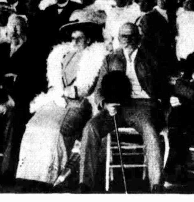
The Governor, Sir John Fuller, addressing the children at the 'All-Australian' planting 
on June 27, 1913. 

It has been suggested that the planting of wattle trees on Alexandra Avenue and near the Anderson Street bridge, may have been due to the influence of the Premier, Sir Thomas Bent. For instance in 1909 it was reported that it is about five years since the late Sir Thomas Bent, then Premier, expressed a desire that a number of our native acacias should be planted on some then vacant ground, near the banks of the river (12). And in 1913 The Herald wrote this about why native trees were planted near the Anderson Street bridge in this connection the Government has followed in the direction of Sir Thomas Bent, who was an enthusiastic admirer of all Australian flora, and wattles in particular (13)It may be so, but I prefer my interpretation that it was Carlo and George Cooper who influeneced the planting and they may well have influenced the Premier.  It was well known that Carlo was fond of wattles. The Prahran Telegraph, in article about the landscaping on the St Kilda foreshore said this Mr. Catani has much to say also in favour of the Australian wattle as an ornamental addition to the parks and reserves (14). 

As more evidence of Carlo's fondness for the wattle in 1911, member of Parliament, Harry Lawson, wrote a letter to his local paper, The Mount Alexander Mail. The letter set out a list of wattles, suggested by Carlo, which could be planted so you would have blooms all year round.

WATTLE DAY.
Sir,— With reference to the observance of Wattle Day, I desire to inform you that I recently obtained from Mr Catani, the Chief Engineer of the Public Works Department, a plan for planting different varieties of acacias, whereby it is claimed that perpetual bloom is secured. Mr Catani designed Alexandra Avenue, which is still under his care and supervision. I have inspected his wattle plantations (containing 44 varieties), where the plan is in operation. Mr Catani tells me that he has proved the scheme by actual experience. As it may be of interest to your readers, I enclose the list. You may be able to find space for them in your columns. —
Yours, etc., HARRY S.W. LAWSON State Parliament House, August 31st, 1911.

Time of Blooming, January. Common Name, New Year Wattle. Botanic Name, Acacia Elata.
February, Lightwood Wattle, Acacia Implexa.
March, Maiden Wattle, Acacia Maidenii.
April, Whipstick Wattle, Acacia Retinodes.
May, Sunshine Wattle, Acacia Discolor.
June, Sweetscented Wattle, Acacia Sauveolens.
July, Cootamundra Wattle, Acacia Baileyana.
August, Silver Wattle, Acacia Dealbata.
August, Coastal Wattle, Acacia Longifolia.
September, Golden Wattle, Acacia Pycnantha (also Acacia Spectabrilisy)
September, Latrobe Wattle, Acacia Acinacens.
October, Scrub Wattle. Acacia Leprosa.
October, Western Wattle,  Acacia Macradenia.
November, Black Wattle, Acacia Mollissima.
December, Black Wattle, Acacia Mollissima
(15).


More Koo Wee Rup Swamp self-seeded wattles.
Main Drain Road, looking west from the Eleven Mile Bridge at Cora Lynn, taken July 31, 2011.

In 1932, a bequest of £5000 from Sir Sidney Myer was reported of in The Herald. The paper had hoped that the generous bequest will forge another link in the scheme for a chain of boulevards and parks along the River Yarra. The scheme was first visualised many years ago by the late Mr Catani, of the Public Works Department. His idea was that a river boulevard should run from the city to Yarra Glen, where it would join the Healesville Road and link up with the highway over the Black Spur and the mountains beyond. Mr Catani's vision was one which has caught the imagination of town planners and beautifiers ever since. Many proposals have been made, although no official comprehensive plan exists....Among the many suggestions made in connection with the boulevard was one that it should be planted with wattles, and known as the Golden Highway (16)How wonderful that would have been and it could have happened if the politicians of the day had the vision and appreciation of beauty that Carlo had.

Acknowledgment
I was alerted to the Alexandra Gardens wattle grove and the all-Australian plantation at the Anderson Street bridge, by my fellow historian and Carlo enthusiast, Isaac Hermann. Thank you.

Trove list 
I have created a short list of articles connected to Carlo and Wattles and the all-Australian plantation on Trove, access it here.

Footnotes
(1) The Advocate, August 27, 1904, see here.
(2) The West Australian, August 4, 1905, see here.
(3) The Australasian, September 25, 1909, see here.
(4) The Australasian, September 25, 1909, see here.
(5) The Age, February 1, 1929, see here.
(6) The Australasian, September 25, 1909, see here.
(7)  Location of Richmond Park


Richmond Park, is bottom left. This is from the Melway Street Directory, Edition 10, 1977.

(8) The Age, August 25, 1904, see here.
(9) The Argus, June 27 1913, see here.
(10) The Herald, June 18, 1913, see here.
(11) The Herald, June 18, 1913, see here. See my Trove list for other articles about planting near the Anderson Street bridge.
(12) The Australasian, September 25, 1909, see here.
(13) The Herald, June 18, 1913, see here
(14) Prahran Telegraph, September 13, 1913 see here.
(15) Mount Alexander Mail, September 1, 1913, see here.
(16) The Age, November 15, 1932, see here.